
Nowadays there are many people who can’t get around in a car without using the GPS. Funny enough, 30 years ago not many people would have heard about Global Positioning Systems. Back in the earliest days, the error between one’s position and the position given by the satellite was big enough to require a series of calculations. Today’s systems do the calculations automatically and way more accurately, so we don’t need to worry about it.
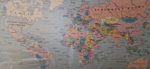 GPS shows where you are, where you want to go, and which route you should take on a map. Today, maps are digitally designed, but mapping is still an art. Cartography (which comes from the French word carte, meaning “map”, and graphy, meaning “draw”) started in prehistoric times. Back then, humans would draw maps on cave walls to determine hunting and fishing grounds. Slowly, the drawing of maps got better and during the Age of Discovery they became essential. Exploring the world in search of raw materials and precious goods has led to an explosion of different maps. These maps were especially used for navigation purposes, but soon geographers were drawing maps reflecting what they were discovering all over the world on land.
Gerardus Mercator was a geographer that lived in the 16th century. He is famous for the Mercator project, which is basically the map we all know and use these days. At the time, it was the most accurate, particularly for navigation purposes. This projection was the result of extensive travelling and many mathematical calculations. Today, this map is contested because it does not respect the true proportionality of continents and countries. For example, Greenland is too big and Africa is smaller than it actually is. Many other projections have been made, especially in the 20th and 21st centuries. One of the most controversial is the Gall–Peters projection, which is a kind of Mercator’s with the right proportionalities.
Google maps have revolutionised maps for the general public because it made them interactive. You can zoom in and zoom out, have different views, analyse different routes. It is not perfectly accurate, but it is enough for people to use it with confidence. Currently, there are many other similar platforms that provide the same services. It now seems that maps are essential for our life: to go from point A to point B, to run on the street, to find the best route, to locate something.
In a globalised world as it is today, it is fundamental that we know the location of the countries, the cities, the villages. In politics and international relations, maps have become crucial to understand the complex relationships between countries, which are limited by their own geography. Although the concept of geopolitics is relatively new, geography has always been important in war (therefore, at some level, in politics, as war is a political matter). The Chinese war general Sun Tzu mentioned it in its book “The Art of War”, which dates from the 5th century.
The idea of mapping the world has expanded to other areas. There are projects to map the ocean and even the universe.
 Tim Marshall wrote a second book, “The Power of Geography: Ten Maps that Reveal the Future of Our World”, detailing issues regarding some of the regions analysed in the first book plus other regions that were not included, like Australia… and the Space. Then, he furthered the Space topic in a third book, “The Future of Geography: How Power and Politics in Space will Change our World”.